


Hopefully I’m not the first person to learn the hard way when I arrived at a trailhead that I’d have to find my way around a controlled burn. It’s happened twice, most recently when a controlled burn begun on a Wednesday was still smoldering in several trees on the side of the trail when I passed them on Saturday after 3:00 p.m. Fortunately, the Florida Department of Agriculture and Consumer Services provides an easy link to allow you to know if the trail you plan to hike is burning.

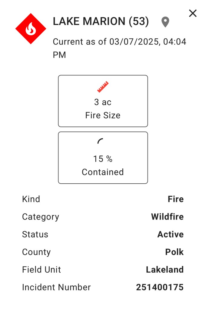
At https://ffs.firesponse.com/public/, you can find an easy-to-use interactive map of the state of Florida, showing locations of all known wildfires and controlled burns. The website uses color-coding to distinguish between fires known to be active (red) and contained (brown). Then when you click on the icon, the website provides details about the fire, including its location, size, whether it’s a controlled burn or wildfire, what percentage of the fire is contained, and when the information you’re reading was last updated.
By using this website, hopefully many of you will avoid the disheartening experience of seeing smoke on the horizon and wondering whether you’d driven all the way to a trailhead just have to a sign like this draped across the trail:

Discover more from Central Florida Backpacking Desk Jockey
Subscribe to get the latest posts sent to your email.
